- Login
Emanuel Bowen (1714 - 1767)
Item 1 of 1
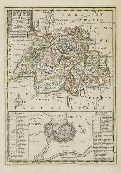
| A new & accurate map of Switzerland with it′s allies and subjects. Composed from ye most approv′d maps & c. and regulated by ast | |
| Emanuel Bowen (1714 - 1767) | |
| 1013 | |
CHF 150 -
| |
| Unknown | |
| Unknowns | |
| 34 cm - 23 cm (13.39 in - 9.06 in) | |
| Signedin to unlock | |
| Auction 06/05/2015 | |
| May 05, 2015 |
A new & accurate map of Switzerland with it′s allies and subjects. Composed from ye most approv′d maps & c. and regulated by ast
1013
CHF 150 -
Unknown
Unknowns
34 cm -
23 cm (13.39 in -
9.06 in)
May 05, 2015