- Login
Thomas Kitchin (British, 1718 - 1784)
Item 1 of 1
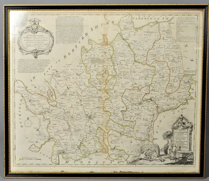
| a new improved map of Hertfordshire divided into its hundreds with roads and distances | |
| Thomas Kitchin (British, 1718 - 1784) | |
| 280 | |
£150 -
£200 | |
| Unknown | |
| Unknowns | |
| 22 cm - 26.5 cm (8.66 in - 10.43 in) | |
| Signedin to unlock | |
| Auction 24/01/2014 | |
| Jan 23, 2014 |
a new improved map of Hertfordshire divided into its hundreds with roads and distances
280
£150 -
£200
Unknown
Unknowns
22 cm -
26.5 cm (8.66 in -
10.43 in)
Jan 23, 2014