- Login
Thomas Kitchin (British, 1718 - 1784)
Item 1 of 1
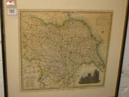
| The West Riding of Yorkshire | |
| Thomas Kitchin (British, 1718 - 1784) | |
| 782 | |
£40 -
£60 | |
| Unknown hand coloured map with title cartouche and compass rose, 2 items | |
| Unknowns | |
| 8.75 cm - 10.75 cm (3.44 in - 4.23 in) | |
| Signedin to unlock | |
| Auction 12/04/2006 | |
| Apr 11, 2006 |
The West Riding of Yorkshire
782
£40 -
£60
Unknown hand coloured map with title cartouche and compass rose, 2 items
Unknowns
8.75 cm -
10.75 cm (3.44 in -
4.23 in)
Apr 11, 2006